File:Flattery Rocks Reservation EO 703 illustration.jpg
Jump to navigation
Jump to search
Size of this preview: 636 × 599 pixels. Other resolutions: 255 × 240 pixels | 509 × 480 pixels | 815 × 768 pixels | 1,087 × 1,024 pixels | 1,874 × 1,766 pixels.
Original file (1,874 × 1,766 pixels, file size: 448 KB, MIME type: image/jpeg)
| This is a file from the Wikimedia Commons. Information from its description page there is shown below. Commons is a freely licensed media file repository. You can help. |
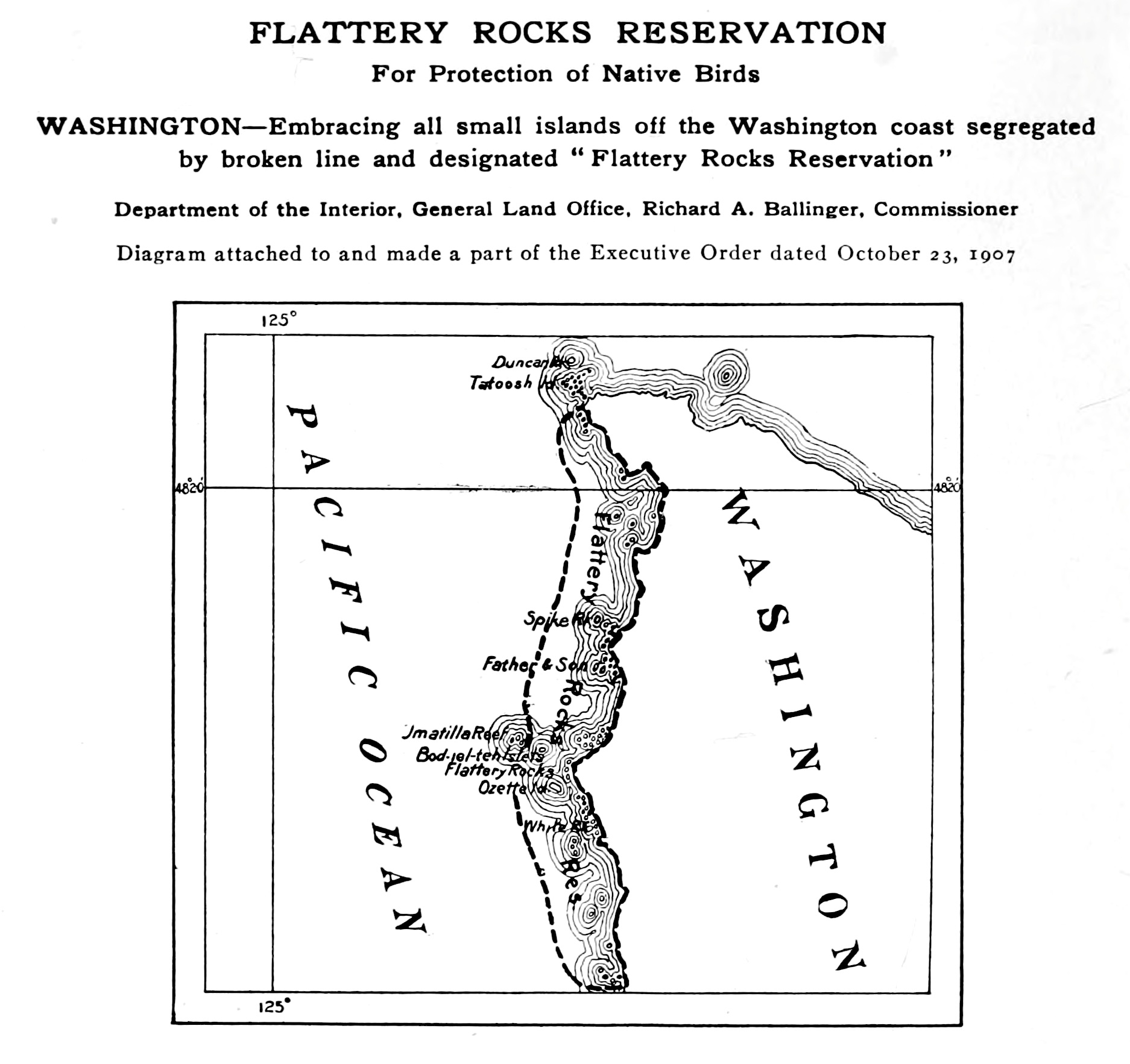
| Description | Illustration of the Flattery Rocks Reservation, off the coast of Washington. This map is an attachment to s:Executive Order 703 which originally defined the reservation in 1907 (which is today the Flattery Rocks National Wildlife Refuge). | |||||
| Date | ||||||
| Source |
From Bird Lore, Volume IX, No. 6, archive.org scan, on page 292. |
|||||
| Author | U.S. Department of the Interior | |||||
| Permission (Reusing this file) |
|

File history
Click on a date/time to view the file as it appeared at that time.
| Date/Time | Thumbnail | Dimensions | User | Comment | |
|---|---|---|---|---|---|
| current | 02:14, 22 May 2010 | | 1,874 × 1,766 (448 KB) | Clindberg | better archive.org scan |
| 15:44, 16 May 2010 |  | 2,825 × 2,750 (572 KB) | Clindberg | {{Information |Description=Illustration of the Flattery Rocks Reservation, off the coast of Washington. This map is an attachment to s:Executive Order 703 which originally defined the reservation in 1907 (which is today the [[w:Flattery Rocks National |
File usage
The following page uses this file: