File:Map of the Country of the Five Nations belonging to the province of New York and of the Lakes near which the Nations of Far Indians live with part of Canada taken from the Map of the Louisiane done 1730.png
Jump to navigation
Jump to search
Size of this preview: 800 × 510 pixels. Other resolutions: 320 × 204 pixels | 640 × 408 pixels | 1,024 × 653 pixels | 1,451 × 925 pixels.
Original file (1,451 × 925 pixels, file size: 1.52 MB, MIME type: image/png)
| This is a file from the Wikimedia Commons. Information from its description page there is shown below. Commons is a freely licensed media file repository. You can help. |
Summary
| Description |
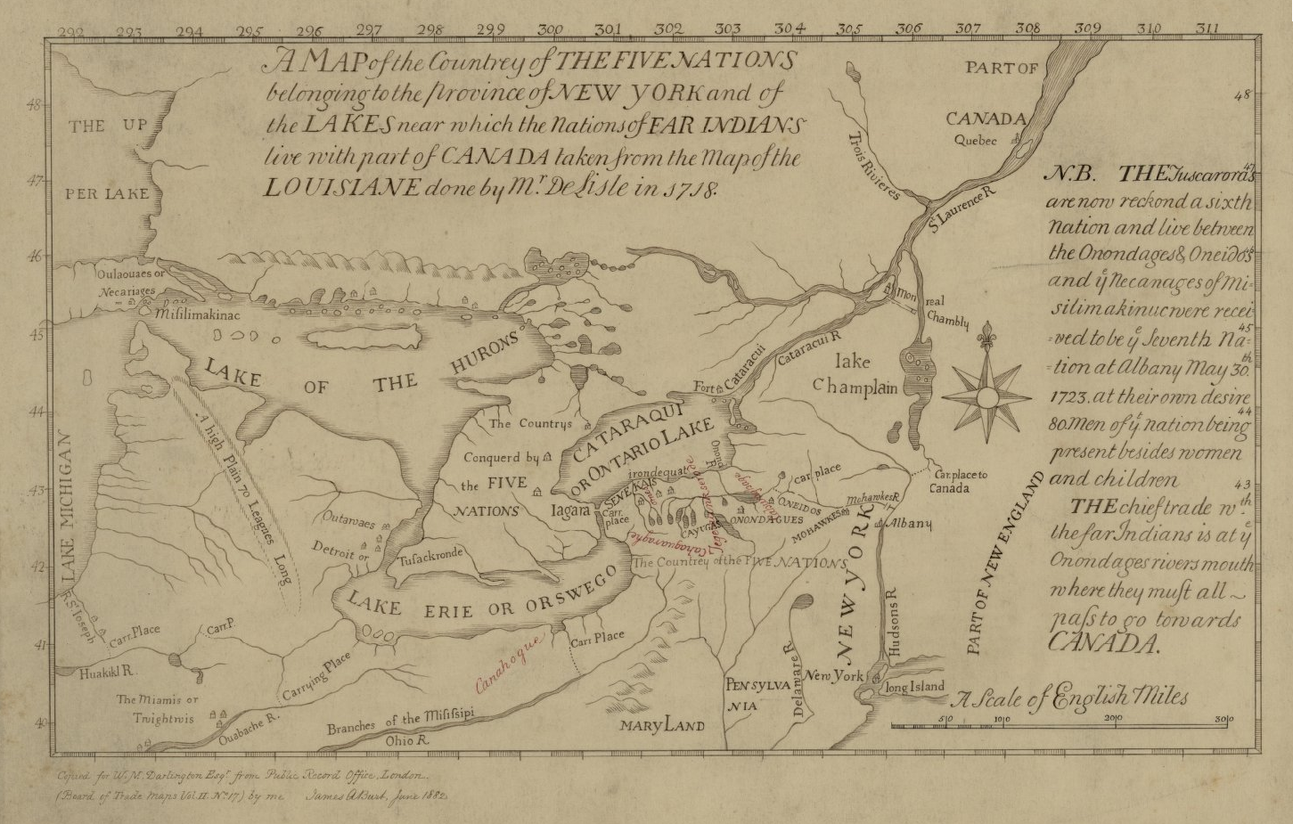
English: This is a map of the Five Nations that is part of the Darlington map collection housed in the Archives Service Center, University Library System, University of Pittsburgh, Pittsburgh Pittsburgh, PA US |
| Date | |
| Source | The Darlington Collection |
| Author | Unknown author |
Licensing
|
This is a faithful photographic reproduction of a two-dimensional, public domain work of art. The work of art itself is in the public domain for the following reason:
The official position taken by the Wikimedia Foundation is that "faithful reproductions of two-dimensional public domain works of art are public domain".
This photographic reproduction is therefore also considered to be in the public domain in the United States. In other jurisdictions, re-use of this content may be restricted; see Reuse of PD-Art photographs for details. | ||||
File history
Click on a date/time to view the file as it appeared at that time.
| Date/Time | Thumbnail | Dimensions | User | Comment | |
|---|---|---|---|---|---|
| current | 15:40, 16 June 2021 | | 1,451 × 925 (1.52 MB) | Psiĥedelisto | (Slightly) higher quality version from same source. |
| 12:26, 29 August 2020 |  | 936 × 585 (705 KB) | User-duck | Cropped narrower using CropTool with precise mode. | |
| 22:17, 12 June 2017 |  | 980 × 593 (799 KB) | Barbara (WVS) | User created page with UploadWizard |
File usage
The following page uses this file:
Global file usage
The following other wikis use this file:
- Usage on azb.wikipedia.org
- Usage on en.wikipedia.org
- Usage on es.wikipedia.org
- Usage on fr.wikipedia.org
- Usage on pt.wikipedia.org
- Usage on ro.wikipedia.org
- Usage on vi.wikipedia.org
- Usage on www.wikidata.org