There was a problem when proofreading this page.
2602
ROAD TRAFFIC
SCHEDULE 2—Markings on the road (contd.)
An image should appear at this position in the text. To use the entire page scan as a placeholder, edit this page and replace "{{missing image}}" with "{{raw image|UKSI19810859.pdf/144}}". Otherwise, if you are able to provide the image then please do so. For guidance, see Wikisource:Image guidelines and Help:Adding images. |
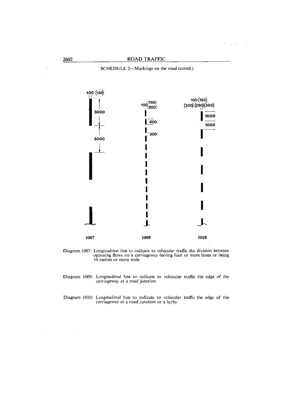
1007
An image should appear at this position in the text. To use the entire page scan as a placeholder, edit this page and replace "{{missing image}}" with "{{raw image|UKSI19810859.pdf/144}}". Otherwise, if you are able to provide the image then please do so. For guidance, see Wikisource:Image guidelines and Help:Adding images. |
1009
An image should appear at this position in the text. To use the entire page scan as a placeholder, edit this page and replace "{{missing image}}" with "{{raw image|UKSI19810859.pdf/144}}". Otherwise, if you are able to provide the image then please do so. For guidance, see Wikisource:Image guidelines and Help:Adding images. |
1010
| Diagram 1007: | Longitudinal line to indicate to vehicular traffic the division between opposing flows on a carrigeway having four or more lanes or being 10 metres or more wide |
| Diagram 1009: | Longitudinal line to indicate to vehicular traffic the edge of the carriageway at a road junction |
| Diagram 1010: | Longitudinal line to indicate to vehicular traffic the edge of the carriageway at a road junction or a layby |